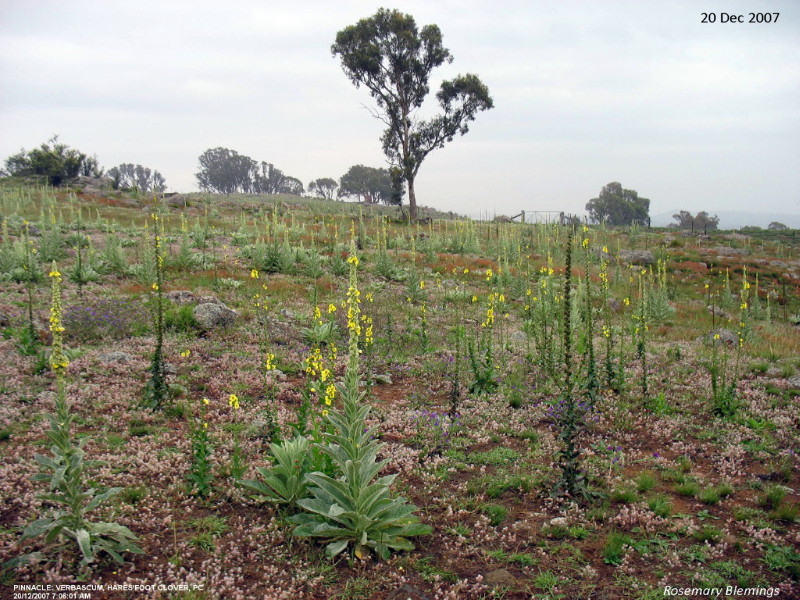
One of fotpin's main target weeds for many years has been Verbascum, both
V. thapsus (Great mullein) and V. virgatum
(Twiggy mullein). Both are captured in the first photograph below taken by
Rosemary Blemings in December 2007. V. thapsus are the paler plants with
thicker flower stalks, while V. virgatum are the darker, thinner plants.
Both form large, flat rosettes and have the ability to invade an area, smothering other seedlings. If left
untreated they produce tall stalks topped by capsules containing thousands of seeds, as shown in the photograph.
Up to and including 2010 control was by sporadic grubbing, lopping and bagging of seed heads, like much of the
reserve. In 2011 the area surrounding the patch shown in the photo was selected for a strict regime of systematic
control of Verbascum. This area is shown on the map below, along with
the location and direction of the photo.
Control consisted of spraying twice a year (autumn and spring), supplemented by lopping and bagging as required
but the rosette spraying regime minimised the amount of stalking and seed set that occurred. Occasionally
a third spray was required in seasons with heavy germination rates. Irregular spraying of St. John's Wort
has also been carried out at least annually, with the
exception of 2012-14, 2021-22 and 2023-25.
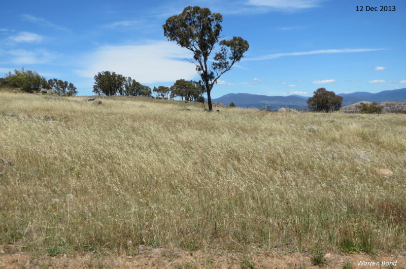
Follow-up photos were taken in December 2013, December 2024 and
December 2025 from as close as possible to the same spot as in 2007.
These show that the control measures had an immediate visual impact and that has continued.
As well as the visual improvement, species diversity has also improved. Although there has been
no systematic survey, 43 native grass
and other ground-layer plant species have been observed in the 1.3 ha controlled patch
since 2020 (see list below).
The amount of effort required to control Verbascum has also decreased.
There is seasonal variation but an overall steady decline with time has been documented.
There is not yet complete eradication meaning that, even after 15 years, continued biannual treatment
is still required.
Map of the area receiving systematic Verbascum control
The yellow dot and line show the position and direction of the photos taken at the junction of the Central and Dowling (Boundary)
tracks. The area that has received biannual Verbascum control is outlined in red.
Native ground-layer species found in this area since 2020