

Maps of The Pinnacle Nature Reserve
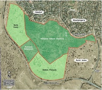
showing the location of The Pinnacle Nature Reserve in relation to the surrounding suburbs and other parcels of land
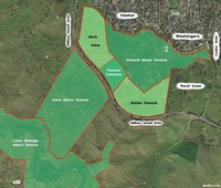
showing the relationship of The Pinnacle Nature Reserve to the Kama Nature Reserve and the Lower Molonglo Nature Reserve, and the corridor created by the 2016 Pinnacle Extension
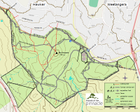
showing the major walking tracks on The Pinnacle Nature Reserve with elevation contours; links to high resolution and printable downloads
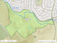
showing the location of streams, dams and the water divide between the Ginninderra Creek and Molonglo River Catchments overlain on a 4 m contour map
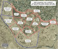
showing the names that fotpin uses to describe the different management zones of the reserve
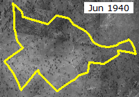
showing the changes in vegetation and other features between 1940 and the present