

Suggested Walks on The Pinnacle Nature Reserve
Central-Valley Loop
Starting point: car park opposite De Salis St, Springvale Drive
Distance: 3.7 km return
Time: Allow 1 hour 30 minutes
Difficulty: Moderate
 Grade 3 |
Total ascent/descent: 130 m |
Description: A circuit via The Pinnacle summit with its spectacular views and passing some of the reserve’s loveliest woodland and the reserve’s only permanent dam. The Pinnacle summit offers spectacular views out over the Molonglo Valley to the ranges beyond, after which a downhill walk takes you to the reserve’s southern boundary and more views out to the Brindabellas. The return track passes near the reserve’s only permanent dam. Don’t forget to take the detour to the dam and check out the interpretive sign for information about the local wildlife.
Directions
| 1. | From the car park take the track through the red boom gate that runs parallel to but outside of the reserve fence.
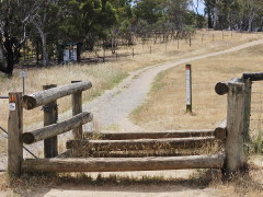
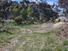
Continue straight ahead, passing a horse cavaletti on your left, and stepping through the second cavaletti
you come to (shown in the photo), until you see the noticeboard on the left. Enter the reserve here then
turn right to walk along the main Central Track.
 |
| 2. |
After 250 m turn left onto a foot track that leads up a short steep section with steps to the
Pinnacle Summit. Continue slightly beyond the summit to the panorama sign that describes the features you can see in this wonderful 270 degree view. Perhaps backtrack a little to the seat and enjoy the view a little longer. |
| 3. | Then take the foot track leading down the southern side of The Pinnacle and after 200 m rejoin the Central Track. |
| 4. |
Turn left along the Central Track and continue for 400 m without taking any turns along other tracks
until you join the Tully Boundary Track at a T-intersection.
|
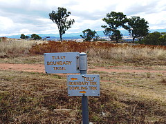
| 5. |
Turn left along the Tully Boundary Track (wrongly posted on the sign as the "Tully Boundary
Trail"). This section of walk winds uphill and down for a while before at its highest point a foot track leads off to the right. This 60 m track leads to another lovely viewing spot over Southern Canberra towards the mountains beyond. 
|
| 6. | Returning to the Tully Boundary Track, turn right and down a steep section towards the point where Deep Creek exits the Reserve. |
| 7. |
Take a sharp left turn before reaching Deep Creek and head back uphill, though less steeply on the
Valley Track. After 200 m look for a sometimes indistinct foot track on your right that leads down to the Dam, where an interpretive sign describes what there is to see there. 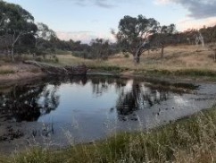
|
| 8. | Retrace your steps back to the Valley Track and continue slightly uphill until you reach a 4-way junction. Turn right to continue along the Valley Track in a northerly direction staying on the western side of the creek. |
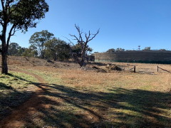
| 9. |
When you come to a fork in the track with the creek crossing and the water tanks just visible in the
distance to the right, take the left, less distinct fork and continue slightly uphill in a northerly direction.
|
| 10. |
After 250 m the track bends gradually to the right. You can often see wildflowers in the area of woodland
ahead and to the left of you. After rounding the bend you'll see a gate into the water tanks compound.
Veer left and take the track slightly uphill then pass around the left side of another gate and continue
outside the compound. Step through the cavaletti, turn right and you will soon see the carpark where you began.
|