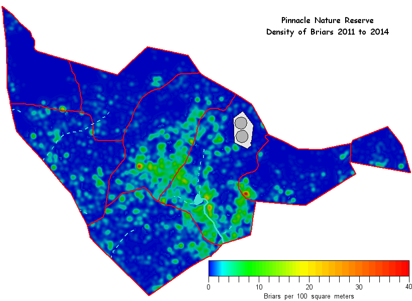
* This map was compiled from the locations of all briars treated between July 2011 and 29 Apr 2014
More briar density maps:
View in Google Earth
Download this file: weed maps/briardensity2011-14_1m.kmz [408 kB] and open it in Google Earth to see the above map overlaid semi-transparently on the latest Google Earth imagery. Tip: To ensure you are looking down vertically in Google Earth, click anywhere on the map and then hit the "R" key on your keyboard.
Other time periods
Go to the briar density maps web page to see maps for each individual season, as well as cumulative maps for 2011-2013, and 2011-2014.